![Dolomites Alta Via2 map [1]](https://gomagcdn.ro/domains3/ancientshades.com/files/product/original/dolomites-alta-via-1-trekking-map-copie-491713.jpg "Dolomites Alta Via2 map [1]")
![Dolomites Alta Via2 map [2]](https://gomagcdn.ro/domains3/ancientshades.com/files/product/original/dolomites-alta-via-1-trekking-map-copie-095363.jpg "Dolomites Alta Via2 map [2]")
Print only, frame not included.
Giclee print, pigment inks.
- Description
- Characteristics
This map documents the complete Alta Via 2 (AV2), also known as the Dolomites High Route 2 — one of the great long-distance hut-to-hut hiking routes of the Italian Alps, running from Bressanone (Brixen) to Feltre through some of the most dramatic mountain groups in the Dolomites.
Built as both a detailed trekking reference map and a piece of mountain wall art, it combines realistic 3D terrain with the route information needed to understand the structure of the full AV2 journey.
Terrain rendering
The mountain relief is a true 3D render, created in Blender from a 15-meter resolution digital elevation model (DEM). Rather than using a flat illustrated background, the terrain preserves the actual form of the Dolomites — ridges, valleys, passes, plateaus, and steep mountain faces are rendered with genuine topographic depth and directional shadow.
The complete map is produced at very high resolution, allowing fine terrain detail, trail information, and geographic labels to remain clear at large print sizes.
Alta Via 2 route information
- The complete classic Alta Via 2 trail is marked from Bressanone/Brixen to Feltre
- Mountain huts (rifugi) used along the AV2 hut-to-hut route are clearly identified
- Major summits, named passes, and key geographic features are labeled throughout the hiking corridor
- Settlements, access valleys, roads, and connecting trails provide wider geographic context
- The route is shown across the surrounding Dolomite landscape rather than isolated from the terrain, making it easier to understand how each stage relates to the mountains around it
12-day hut-to-hut itinerary
A dedicated planning panel divides the Alta Via 2 into a classic 12-day trekking itinerary, with each stage showing:
- Distance in kilometers
- Estimated hiking time
- Elevation gain
- Elevation loss
- An individual elevation profile chart showing the shape of the climbs and descents
The stage profiles make it easy to compare consecutive days and identify the more demanding sections of the trek — useful when researching Alta Via 2 hut bookings, stage lengths, backpacking plans, and daily elevation changes.
For hikers preparing for the Dolomites Alta Via 2, the map provides a single visual overview of the complete journey. For those who have already walked the route, it works equally well as a detailed record of one of the classic multi-day hiking adventures in the Italian Dolomites.
♥ Printed on premium matte paper (230g/sqm);♥ All prints have an additional 0.25 inches (6 mm) white margin; for example, if you select the size 20 x 30 inches, the overall paper sheet will be 20.5 x 30.5 inches; this additional white margin goes beneath the frame, not visible; so, the necessary frame, in this case should have an opening of 20 x 30 inches;
♥ Pigment inks (Canon Lucia EX) which last a lifetime, no fading;
♥ Giclée fine reproduction, using one of the best fine art printers, Canon imagePROGRAF 4000;
♥ The minimum size available is determined by the readability of the text on the map.
► Shipping is done in a rigid tube;
► The frame is NOT included.
● For any other info please let me know and I will get back to you within 24h.
● On this site, www.AncientShades.com, you can find thematic and modern maps.
● Vintage maps reproductions are available here: www.etsy.com/shop/AncientShades
● On my Facebook page I post promotions and special products: https://www.facebook.com/AncientShades
● Please read the shop policies for important information.
♥ Thank you! ♥

Map Type: Detailed relief map
Recommendations

Pyrenees minimalist map, shaded relief map, highly detailed, impeccable precision, "cold" version
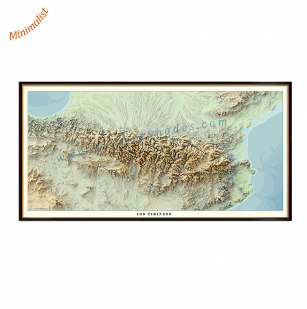
Pyrenees minimalist map, shaded relief map, highly detailed, impeccable precision, "warm" version